The BBC's Richard Scott is the first journalist to be allowed inside the Virgin Galactic spaceship and files this report.
Thursday, March 31, 2011
Zubrin Advances Heavy-Lift for Mars
Dr. Robert Zubrin, President & Founder of the Mars Society, gave an address at the University of Washington in Seattle on February 25, 2011 on his "Mars Direct" plan and efforts to send humans to the Red Planet within a decade.
Earth's Gravitation Map Revealed by ESA
After just two years in orbit, ESA's GOCE satellite has gathered enough data to map Earth's gravity with unrivalled precision. Scientists now have access to the most accurate model of the 'geoid' ever produced to further our understanding of how Earth works, according to the European Space Agency.
NASA JPL Provides 3-D Images of Mars
Get out your red-cyan glasses and travel with NASA spacecraft. See everything from solar flares to rover tracks on Mars... in 3-D. Images in order of appearance are from the following: Mars Pathfinder, Phoenix Mars Lander, Spirt and Opportunity Rovers, the HiRISE camera on Mars Reconnaissance Orbiter, Deep Space Network antennae, STEREO mission to the sun and Voyager, provided by NASA JPL.
Trick For Activating +1 Button On Google

Read more »
LEND Looking for Water on the Moon
How would you find out where to look for water on the Moon? NASA's Lunar Reconnaissance Orbiter has a unique answer: Count the neutrons coming from the Moon! By measuring the relative amounts of slow and fast neutrons coming from soil on the Moon, scientists think they can estimate the amount of hydrogen. And it's believed that where there's hydrogen, there might also be water! Find out more about LEND by watching this video from the NASA/Goddard Space Flight Center.

Sunset, Channel, and Late Winter Woods
Yesterday was a gorgeous late winter - early spring day here in Grand Marais. Temperatures were in the upper 30s, which made the skiing a little slushy. But today's posting starts with several shots of the beautiful sunset we had last night.


Earlier in the day I snapped off a couple of photos showing the channel, pier, and breakwater from the top of Airport Road. As some of you know, the town of Grand Marais was originally situated on East Bay, since the west bay was originally land locked. After the Soo Locks opened in 1855, the channel was dug to open up the west bay in Grand Marais. In 1859 in a gale, the ship MANHATTAN, a pioneer lake passenger steamer, was wrecked at the entrance trying to gain shelter into the bay. The 330 ton ship, plotted by Captain John Spaulding, foundered in the channel, partially blocking it for 20 years. On July 29, 1871, it was reported in the Marquette Mining Journal: “This beach is strewed with wrecks from the Pictured Rocks to Whitefish Point, and we venture to say that for want of a harbor on that line of coast, there has been more money value of shipping lost than would suffice to pay the cutting of a proper ship channel from the lake to the harbor at Grand Marais five times over.” Soon thereafter, the Federal Government inspected the site and recommended that a channel to the west of the natural entrance be dug, to be protected by timbered piers. By 1880, lake traffic had reached such a volume that Grand Marais harbor was made an official harbor of refuge and improvements recommended a decade earlier to Congress began. A new channel 75 feet wide and 10 feet deep was cut cross the extreme eastern end of Coast Guard Point in 1883. The dredging wad done by C.S. Baker of Sault Sainte Marie, and J.S. Gillette of Marquette had the contract for furnishing lumber and stone for cribbing. The big blocks of red sandstone and crib fills came from the quarry of John Thoney near the Little Garlic River north of Marquette. In June 1883 the Mining Journal noted “…the cribwork will extend 650 feet into the lake and as soon as a fine harbor is available, it will become the seat of extensive lumbering operations as a vast body of pine lies along tributary streams.” Then, in 1894 a mile long pile dike of breakwater was built from the east pier, across the old harbor channel to Lonesome Point.
For the heck of it I plugged in key words regarding the channel into Grand Marais bay into a search engine to see what I could find out. The following came up on what I think is a current Army Corps of Engineer web site. It has been a while since they dredged our channel, but maybe they are planning on doing so again.
Grand Marais Harbor, Michigan is located on the south shore of Lake Superior, 93 miles west of Sault Ste. Marie, MI. The project was authorized by the River and Harbors Acts of 14 June 1880, and 17 May 1950. Provided for are parallel timber crib and cellar steel sheet piling piers 500 feet apart which have an aggregate length of 4,407 feet and extend out to the 22-foot depth contour in the lake; for closing the natural entrance channel by a pile dike 5,770 feet long; and for dredging a channel 300 feet wide and 18 feet deep between the piers, and 500 feet wide and 20 feet deep in the lake approach. The harbor services primarily recreational navigation interests.


During the late afternoon I skied the fields and woods over by Sable Falls. Although it was slushy, skiing was still possible.


Wednesday, March 30, 2011
Ariane 5 rocket aborts launch at Kourou
An Ariane 5 rocket countdown at the Guiana Space Center in Kourou, French Guiana was cut off seconds before liftoff on March 30,2011 in a dramatic abort after the launcher's hydrogen-fueled main engine ignited The aborted launch was due to a main engine glitch seven seconds after the engine ignited. A new launch date will be set after determining the exact nature of the launch malfunction. More from Space.com. Video: Arianespace.
ESA Satellite Radar Data Show Japan's Earthquake Displacement

Satellite images have been essential for helping relief efforts in Japan following the massive quake that struck on 11 March. Now scientists are using ESA’s space radars to improve our understanding of tectonic events.
Scientists are calling on data from the advanced radar on ESA’s Envisat satellite to map surface deformations caused by the magnitude-9 earthquake. Studying data acquired on 19 February and 21 March, scientists from NASA’s Jet Propulsion Laboratory have detected a ground shift of about 2.5 m eastwards and a downward motion of Honshu Island’s east coast.
Scientists from Italy’s Istituto Nazionale di Geofisica e Vulcanologia have used the same Envisat data to show a large portion of the surface displacement, with a maximum shift of 2.5 m, according to the ESA.
MESSENGER Takes First Picture While in Mercury's Orbit: Many more to come!
The MESSENGER spacecraft captured its first image of Mercury since entering the planet's orbit. The picture was of previously unseen terrain near the small, rocky planet's south pole. The snapshot is part of the "checkout phase" conducted for the spacecraft that'll include its taking around 75,000 images of Mercury's surface. Full operations to study the planet's geology, formation and history are scheduled to begin April 4, 2011.
Spring is not far away
Now that I have completed the room swap in my house for the most part, as well as my accounting, tax preparation, and custom orders -- it is time to start developing the online rockhounding classes. As I reported on either this blog or on my web page, I am developing the classes using a technique I learned in graduate school called "The Future's Language." It is a process used to develop active learning exercises focusing totally from participant's perspective. Using the process, yesterday I wrote the conceptual map and started to collect information into a data base. I'll be conducting the research over the next couple of weeks and then will compile it into the online rockhounding adventures. After that I'll have to test the class content and structure before turning it over to my webmaster for conversion to the Internet format. This will be a fun process. I am hoping for a launch of the classes in June, but it could be either in May or July depending on how things go.
Last night we had a nice sunset after glow.

This week I have snowshoed around in the woods a couple of times as well as skied the old farm fields. In the spring the snow condenses, sometimes helped by light rain. When we have cold nights, the remaining snow freezes solid allowing you to walk or ski on top. It is especially fun in the fields because you get a terrific glide and can seemingly float around the field. The skiing is almost effortless.
As I have walked around the woods and skied the fields, it is amazing how many "artifacts" you see. I didn't take pictures of all of them, including several old items in the fields by Sable Falls. Below are some of the items I have seen.


I also walked around the bay the other night. The ice is starting to melt, but it is still too early to tell if the sand has piled up more to further widen the beach. It looks like the high water mark has receded another 100 feet or so, further widening the beach on the south side of the bay.

The water is really flowing out of the Sucker River. It looks like the river has moved further west as it's mouth is now a hundred feet wide.


In my yard the snow is also starting to recede. Objects are now starting to show through. Although there is still two feet of snow in the woods, out in the open there are bare spots. In my yard the snow is less than a foot deep.

Successful Re-entry of Japanese HTV2

The Japanese H-II Transfer Vehicle "KOUNOTORI2" (HTV2) successfully re-entered the atmosphere over the East Coast of New Zealand after the third de-orbit maneuver at 11:44 a.m. on Wednesday, March 30, 2011 (JST). The HTV2 successfully accomplished the main objective of shipping cargo to the International Space Station, and completed all of its mission objectives over 67 days with today's re-entry.
Tuesday, March 29, 2011
ant in drop of water
this photo of an ant stuck in a water droplet was captured accidentally by photographer adam gormley.
 (link)
"Trapped in a tiny perfect sphere of water, this unlucky ant is unable to escape. A sudden downpour gave it no time to take cover, and photographer Adam Gormley was there to snap the image. Adam, from Noosaville, Queensland, Australia, had been photographing spiders in his neighbour's garden when the rain came down. He had no idea there was an ant in one of the three millimetre droplets until he viewed the images later. He said: "I thought it was some dirt inside the drop, and it was not my main focus, I liked the way the drop was sitting on the aloe-vera leaf, with the tiny hairs. When I uploaded the shot to my PC, I viewed it large, and I think I shouted out loud in excitement when I realised what I'd captured by accident!" "

"Trapped in a tiny perfect sphere of water, this unlucky ant is unable to escape. A sudden downpour gave it no time to take cover, and photographer Adam Gormley was there to snap the image. Adam, from Noosaville, Queensland, Australia, had been photographing spiders in his neighbour's garden when the rain came down. He had no idea there was an ant in one of the three millimetre droplets until he viewed the images later. He said: "I thought it was some dirt inside the drop, and it was not my main focus, I liked the way the drop was sitting on the aloe-vera leaf, with the tiny hairs. When I uploaded the shot to my PC, I viewed it large, and I think I shouted out loud in excitement when I realised what I'd captured by accident!" "
Albino Deer and Channel Photos
When my friend, Helen, and I were heading back to my house the other night we were treated to deer seemingly every where. First I got a shot of deer over by First Creek at the end of Woodland Park.

I didn't get a photo, but there were a dozen or so deer by Sable Falls. Then after driving up the hill just west of the falls, we were surprised when we spotted deer right next to the road, including the albino.

Albinoism is a recessive trait found in mammals, birds, reptiles, fish, plants, and even humans. Both parents must have the recessive gene for it to manifest in the offspring. This recessive gene does not allow the albino to have normal coloration because they don't produce the enzyme responsible for skin, hair, and tissue pigment.
The poor guy seemed to be limping a bit. At first I thought the darker area on his back right leg is an injury, but I have now been educated by my son, Jonathan, that it is instead a scent gland. He also had dirt on his face.


The eyes of a true albino are pink because blood vessels behind the lenses show through the unpigmented irises. The white color makes it hard for albino deer to conceal themselves. I don't think it is a coincidence that this albino deer seems to hang out near a white birch forest. I looked up on the Internet how frequent it is to see an albino white tail deer. From what I can tell only one in a million is an albino, although some references said the number is closer to one in every 30,000.

Like me, Helen was a summer kid in Grand Marais. She now lives in Marquette and has not been back to town much this past few years. So for old time sake we drove around a bit. Here are some shots I took down on the end of Coast Guard Point.


Monday, March 28, 2011
HTV-2 Kounotori to Make Last Call to Japan
The spacecraft, Japan's unmanned cargo ship Kounotori 2, is due to intentionally burn up Tuesday when it re-enters Earth's atmosphere one day after leaving the International Space Station. In addition to the station trash packed on Kounotori 2, a high-tech sensor is ready to track the finer details of the spacecraft's doom, writes Leonard David for Space.com. A so-called Re-entry Breakup Recorder – or REBR for short – small and autonomous sensors will record the firey re-entry into the Earth's atmosphere. It shuld provide some quite interesting video on the pull through the gravity well.
Epic Snowshoe--Second Posting
Today's photo blog posting includes the second batch of pictures from our long snowshoe hike in the dunes. Since today's pictures include some of Lake Superior, I decided to look up a few facts:
--Lake Superior is 350 miles long and 160 miles wide, encompassing 31,700 square miles of surface area.
--The deepest spot in Lake Superior is 1,333 feet, which is located 46 miles southwest of Caribou Island, or 25 miles northeast of Grand Marais. The average depth is 482 feet. The deepest lake in the U.S. is Crater Lake in Oregon at 1,644 feet.
--There are 425,000 Canadians and 181,500 Americans who live in towns and communities around Lake Superior.
--There are 2,725 miles of shoreline around Lake Superior, including that of all the islands. That is about the same as it is from Key West, FL to Seattle, WA. The shoreline length of the lake without the islands is 1,826, which is farther than it is from Chicago to Los Angeles, which is 1,747 miles.
--There are 78 species of fish that live in Lake Superior.
--The highest elevation of Lake Superior occurred in 1876 at 602.8 feet above sea level. The lowest level of the lake ever recorded was in September of 2007 at 598 feet.
--In most places Lake Superior's pristine water allows 65 to 75 feet of visibility.
--There are 3,000,000,000,000,000 gallons of water in Lake Superior, or 4440 trillion cubic feet. This represents 10% of the world's fresh water, or enough to flood all of North and South America one foot deep.
--Lake Superior could hold the water from all of the other Great Lakes, along with three more Lake Eries.
--There are 200 rivers that drain into Lake Superior.
--It takes at least 200 years for all the water in Lake Superior to complete flush and be replaced.
--The average temperature of Lake Superior is 40 degrees Fahrenheit. The average temperature has increased 4.5 degrees since 1979, compared to an average increase of the air temperature in the region of only 2.7 degrees. This is most likely due to decreased ice cover, which results in more solar radiation heating the water.
--The maximum wave ever recorded in Lake Superior was 31 feet tall.
--There have been 350 shipwrecks with 1,000 lives lost in the waters of Lake Superior.
The photo below shows floating ice gathered off of Au Sable Point.

Below is a view of Au Sable lighthouse taken using my camera's zoom. This shot was taken from the bluff around half-way between the log slide and Sable Falls.

Here is a shot with Helen, Wendy, and Kim standing on a dune near the bluff.

More iceberg photos...


Our snowshoe trail...

Another snow melt pattern...

Our car was parked at Sable Lake. So after walking east along the bluff for a while, we headed south to work our way back to the Sable Lake area. We had to bushwhack it through the forest and climb a dune, which provided a different view of Sable Lake.

We ended up on the high dune across from the overlook. Here is a shot of Helen carefully descending the dune. The entire hike was hard, but beautiful and incredible.

How To Create A Poll Question On Facebook

Read more »
Sunday, March 27, 2011

Lunar lava tube could be settlement location

The Moon Society notes that the Indian Space Research Organization, has released a paper detailing the discovery of a 1.72 kilometer long (5,733 ft.) intact lava tube section in the south western reaches of Oceanus Procellarum, the Ocean of Storms.
The data was compiled by Chandrayaan-1's Terrain Mapping Camera (TMC), one of the eleven science instruments on board India's first lunar orbiter, launched October 22, 2008.
"The TMC image is in the panchromatic spectral range of 0.5–0.75 μm with a stereo view in the fore, nadir and aft directions of the spacecraft movement and with a high spatial resolution of 5 m at an orbital height of 100 km (ref. 1), to enable three-dimensional viewing of the lunar surface with crisp and clear surface features and morphology.
"The Digital Elevation Model (DEM) generated from the three look angles enables morphometric study of various lunar features, thus furnishing topographic relief and dimensions of various morphological entities. "Identifying sites for permanent base stations for possible human settlement on the Moon is important for long-term perspective of lunar exploration."
Lunar and Mars lava tubes are possible settlement locations for a human survival. A nexus between lunar water and lunar lava tubes is also being considered.
Sand Seas of the Solar System Explored
There are four worlds in our Solar System that have substantial atmospheres and observable surfaces: Venus, Earth, Mars, and Titan. The effects of an atmosphere interacting with a surface are clear: each of these planetary bodies has sand seas covering some fraction of its surface. Hidden within the morphology of these dunes lies a record of climate change that scientists are only beginning to understand, according to Dr. Lori Fenton.
Epic Dunes Snowshoe
Yesterday was a BEAUTIFUL day in Grand Marais. Temperatures were in the low 20s and it was sunny. Friend, Helen, from Marquette came to visit so that three of the four of the Grand Canyon hikers could get out for some exercise. So Helen, Wendy, me along with another friend, Kim, started at Sable Lake.

We walked down H58 west for a ways and then headed up into the dunes. We climbed a valley that offered this nice view of white birches.

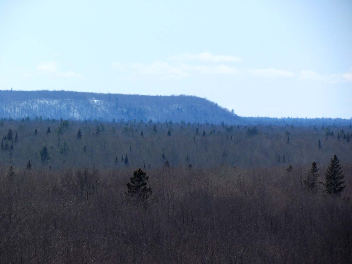
When we finally reached the top of the first dune, we looked back south to see what I think is the Munising moraine. As the glacial ice receded around 10,000 years ago, it stopped at various points and built up land form features known as moraines--ridges that vary in height and composition depending on the length of time the ice remained at a particular point and on the materials that were eroded. Moraines are typically rolling landforms, higher than the surrounding countryside. They are composed of glacial till--a sediment made up of rocks and stones, laid down as the ice rapidly melted. These landforms formed as the ice was temporarily stationary, while internally the ice brought sediment forward and continuously deposited it at the margin. Alternatively, end moraines formed as a glacier readvanced and "pushed" soft sediment in front of it, creating what is often called a "push moraine". The outermost end moraine is given the special name "terminal" end moraine. All others are referred to as recessional moraines, since they mark a recessional position of the ice margin. The Munising moraine was first thought to be an end moraine, but scientists now think that it is a recessional moraine.

Once we were in the dunes, we headed north to the Lake Superior shoreline. Officially, they say the Grand Sable dunes encompass five square miles. I have to tell you that it seems like they are bigger. Here are Helen and I in the middle of the dunes.

Here are some dune scenes....


At several spots we ended up on tall dune ridges. The easiest, safest, and most fun way to get down is to slide on your butt. Actually, I found that by sliding on one hip you can use your elbow as a sort of rudder. Of course, it is important to keep your snowshoes up off the snow while sliding. Here is Helen at the end of her slide. The second picture below has a red arrow that shows the path of our slide.


Here is a neat snow melt pattern.


We walked down H58 west for a ways and then headed up into the dunes. We climbed a valley that offered this nice view of white birches.

When we finally reached the top of the first dune, we looked back south to see what I think is the Munising moraine. As the glacial ice receded around 10,000 years ago, it stopped at various points and built up land form features known as moraines--ridges that vary in height and composition depending on the length of time the ice remained at a particular point and on the materials that were eroded. Moraines are typically rolling landforms, higher than the surrounding countryside. They are composed of glacial till--a sediment made up of rocks and stones, laid down as the ice rapidly melted. These landforms formed as the ice was temporarily stationary, while internally the ice brought sediment forward and continuously deposited it at the margin. Alternatively, end moraines formed as a glacier readvanced and "pushed" soft sediment in front of it, creating what is often called a "push moraine". The outermost end moraine is given the special name "terminal" end moraine. All others are referred to as recessional moraines, since they mark a recessional position of the ice margin. The Munising moraine was first thought to be an end moraine, but scientists now think that it is a recessional moraine.
Once we were in the dunes, we headed north to the Lake Superior shoreline. Officially, they say the Grand Sable dunes encompass five square miles. I have to tell you that it seems like they are bigger. Here are Helen and I in the middle of the dunes.

Here are some dune scenes....


At several spots we ended up on tall dune ridges. The easiest, safest, and most fun way to get down is to slide on your butt. Actually, I found that by sliding on one hip you can use your elbow as a sort of rudder. Of course, it is important to keep your snowshoes up off the snow while sliding. Here is Helen at the end of her slide. The second picture below has a red arrow that shows the path of our slide.


Here is a neat snow melt pattern.

Subscribe to:
Posts (Atom)


